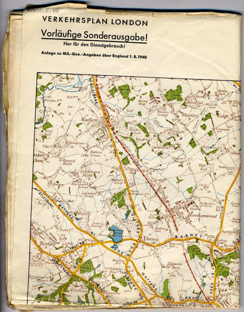
German Army Map of London - Street Map
Maps such as this were intended for use during the invasion of Britain. They detail the landscape, population, roads, railways and waterways and the electricity, telephone and telegraph networks.
This map was issued in 1941. Main roads are marked in yellow.
Object no :
DMMP005a, DMMP005b
Collection :
Creator :
Abteilung fur Kriegskarten und Vermessungsweses (Wartime Maps and Surveys Department)
Place of Production :
Berlin, Germany
Dimensions :
length 940mm, width 740mm; scale 1 : 50 000
Materials :
paper
Location :
NA
Related site :